|
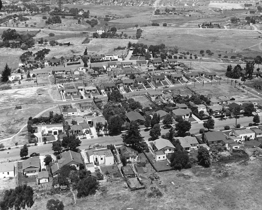
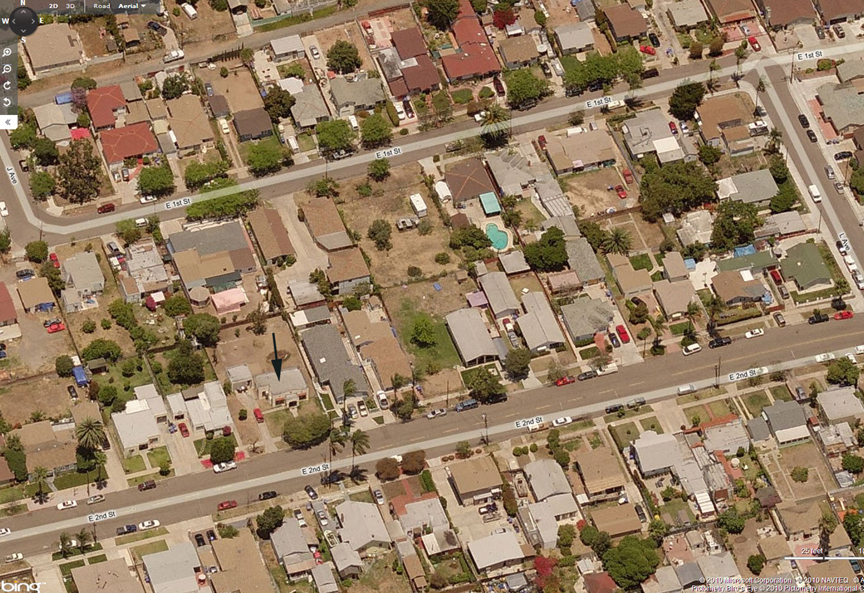
I
have solved Rozelle Mystery Aerial #54. The
house with the black arrow below is at 1019
E 2nd St, in National City. We're looking
north. The same house in Rozelle #54 is near
the left edge toward the bottom, again seen
looking north. Google's Street Level view of
the same house shows that it had a two-track
driveway but the space in between has been
filled in with concrete. The east-west
street about two-thirds of the way up from
the bottom is Division. The broad street
that comes in from the top a little right of
center and terminates abruptly I think is
45th St, stopping at Logan Ave. The military
housing in the Rozelle Photo just east of
there may be the Chollas View units that I
saw in the 1993 Spring issue of The Journal
of San Diego History (online). You have no
idea how much time I've spent trying to
figure this out, and I'm not alone. Betty
Mayfield Picard '75 (a fellow geographer)
and her husband have also been hard at it on
this one. We shared notes last week,
doubling my resolve to figure it out -- Bob
Richardson '61
|
|
|