|
|
|
|
 |
|
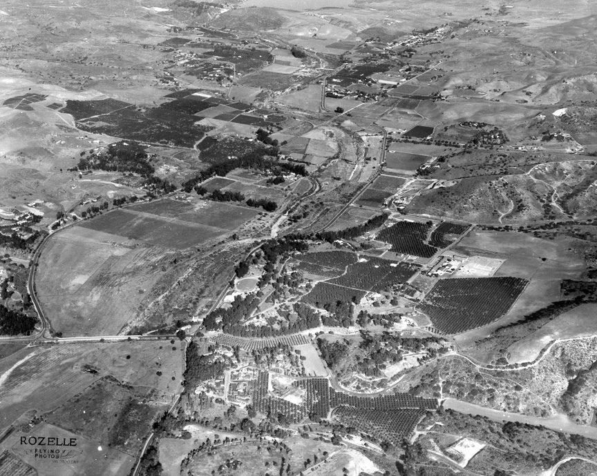
THIS
HOWARD ROZELLE AERIAL has me stumped. It was
taken in 1954. If I had to guess I'd go with
Mission Gorge, but I haven't ruled out Jamul.
It looks like East Bonita with Sweetwater Lake
in the top background -- Pat
Edwards ‘67
Looks like Sweetwater Lake to me with Bonita
in the foreground -- George
Kneeshaw ‘67
We are looking to the east over Bonita Valley,
with the western portion of Sweetwater
Reservoir barely appearing at the top. The
primary street running up the center is Bonita
Road, and as always, the river looks quite
dry. The “tip-off” to me was the portion of
the street coming in from the left that swings
to the left. It’s Sweetwater Road (which then
runs east on the north side of the river). But
if one goes straight at that intersection, you
cross over the riverbed as Willow Street, and
connect into Bonita Road (which then runs east
on the south side of the river). Not in the
photo is the newly opened Route 125 South Bay
Toll Road, which is just before the reservoir.
Yes, this once was an agricultural county, and
the various groves in the photo reaffirm it.
Does anyone recall what was grown in that
area? -- Earl
Feldman ‘61
I believe you're right. I think that's Glen
Abbey Memorial Park in the foreground -- John
Fry
|
|
|
|
|
|
|