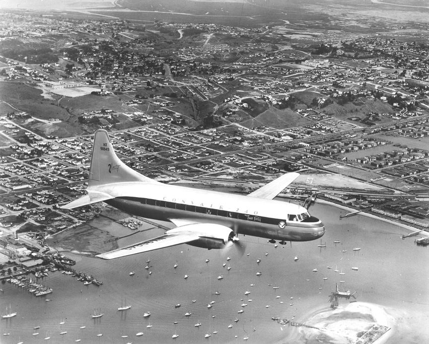
| HOWARD DIDN'T TAKE THIS SHOT.
It's a Consolidated Vultee photo of the
Convair 240 in March 1947. I eventually
figured it out, but it still doesn't quite
look right. There's been a lot of landscaping
changes to this part of San Diego.
My best guess is that the
Convair 240 is just above (what is today)
Point Loma Seafoods, and that Rosecrans is
coming from the center left to the upper
right hand corner of the photo. That makes
the area just behind the plane (near the
hill) being Tunaville and Roseville -- Earl
Feldman ‘61
The photo looks like NTC in
the background with Harbor Drive crossing
the photo to intersect Rosecrans. I love the
early dredging for the future “islands” in
the harbor -- Barbara Bright Wilder ’62
The aerial looks like a dredging operation
was underway, creating Harbor Island. You
can see the artificial shoal in the lower
right of the picture. I think Spanish
Landing is along the bay front to the right.
The airport is not shown, but is to the
right of the picture. The dredging
operations over the years completely changed
the shape of the waterfront here and across
the bay on Coronado -- George Fish '71
The dredge in the right
foreground is forming the east end of
Shelter Island, where Bali Hai is today.
Dana Junior High and Point Loma High School
can be seen at opposite ends of Catalina.
Nimitz Boulevard has not been built and
Mission Bay is mud flats at the top. The
bridge from South Mission to Ocean Beach
SHOULD be visible, but I couldn't locate it
-- JF
|