|
|
|
 |
|
This
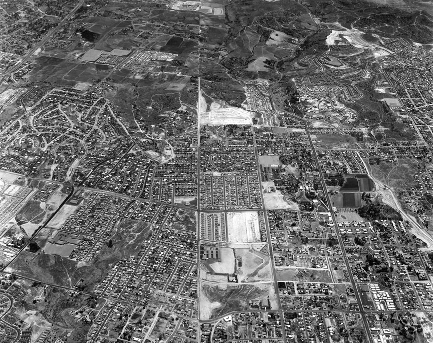
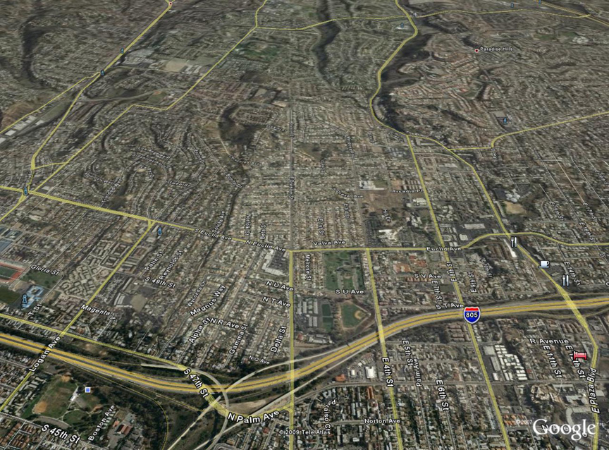
Howard Rozelle aerial IS a mystery!! There's
no date on the back, nor a negative number. As
a matter of fact I guess I don't really know
for sure that Howard took it. Google Earth
people -- start your engines!!! I'm clueless
on this one, but wonder if it's somewhere in
the South Bay.
Howard's
photo is East Division St. and North Euclid
Ave, looking east. I hunted for two street
grids meeting at a slight angle. It is near
the boundary between San Diego and National
City. Your South Bay guess is pretty close --
Mike
Fry ‘60
My guess for Rozelle aerial is E. Division St,
looking east, with N. Euclid Ave as the main
artery going left to right in the center of
photo. That's the only place where the
diagonal streets turn into perpendicular
streets as you go east (or vice-versa).
National City to the right, Lincoln Park and
Valencia Park on the left. Before 805 went in
-- Robert
Laudy ‘73
The photo of San Diego/National City is early
1960s. The school at the top of the
photo is Morse High School, built in 1962. It
looks like the football field/stadium is still
being built at that time. I am a Paradise
Hills "lifer" -- born, raised, and current
resident. I recognize features in all of the
Paradise Hills and National City photos, as
well as some of the other San Diego photos.
Also, I am a teacher with the San Diego
Unified School District. I was at Crawford for
nine years (2003-20011). I loved my time at
the school and still miss it dearly. By the
way, I believe that is Oliver Perry Elementary
School on the top of the hill toward the upper
right corner. That should also be Paradise
Hills Elementary School at the four o'clock
position from Perry Elementary School. Down
the hill and on the long straight away of
Allegheny Street. That baseball field at the
bottom of the photo is El Toyon park
-- Alan Tabiendo
|
|
|
 |
|
|
|
|
|
|