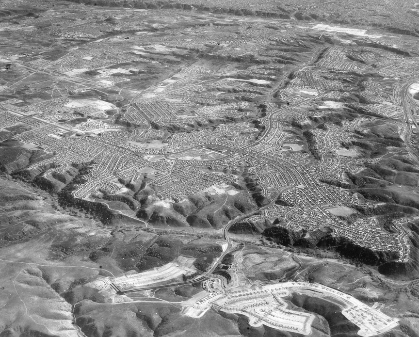
My guess on the photo is that the
plane is above what is now University City
looking south into North Clairemont and
Clairemont. Mission Valley is at the top
edge of the photo. The road coming north
is probably Genesee Ave., but maybe
Regents Road (I don't think that was
constructed until later). To the left
(east) is where 805 is now. 52 (going
east-west) may now be in the valley at the
top/north of the photo. I'll be amazed if
I'm right, but that's my take – Donn Dufford ‘63
Looks like North Clairemont with
Regents Rd in the foreground – Paul Woolery '64
Looks to me the photo is the
beginning of University City at the
bottom, hwy 52 would run in the canyon,
and Clairemont in the middle and top – Gary Morris '61
I believe we are looking
southwest across what is now hwy 52. It
looks like San Clemente Canyon and
surrounding suburbs. I think I can pick
out Clairemont Mesa Boulevard crossing the
canyon. That canyon was a nice quiet place
for a hike even back in the early '70s -- Gary L Smith ’70
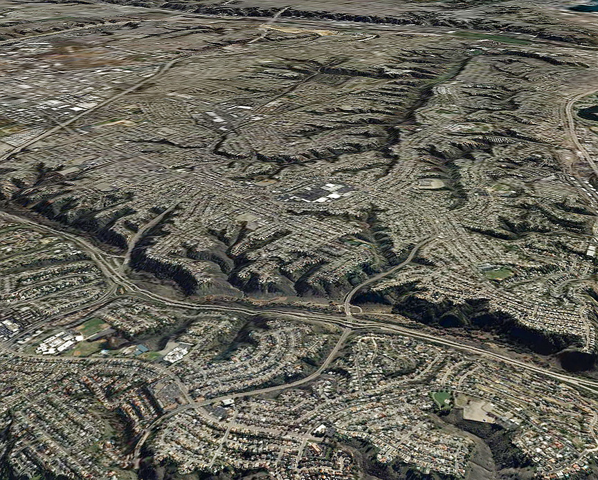
I thought I had guessed the
Rozelle shot correctly, and this time I've
even got proof. It's looking southeast at
San Clemente Canyon with the community of
Clairemont just beyond. Regents Road winds
through the gorge. Mission Valley is at
the top. Attached is the same view today
thanks to Google Earth from a virtual
altitude of 7500 feet -- Owen Western '63